Overview
Filmmakers Camilo de Castro and Brad Allgood sought map graphics for his feature documentary film, Patrol. The film is a character-driven documentary that follows the Indigenous Rama and Afro-descendent Kriol communities in the Indio-Maíz Biological Reserve who are fighting to protect their ancestral lands - and way of life - from the increasing threat of illegal cattle ranching. If you're further interested in the subject matter, do visit the film's website for more information on what you can do to help the cause.
Approach
I received fairly explicit instruction as to what de Castro and Allgood were looking for regarding delivery. They were extremely well-prepared with knowledge of their subject matter with many years worth of data to demonstrate the clear encroachment of illegal cattle ranching on the Indio-Maíz Biological Reserve in Nicaragua.
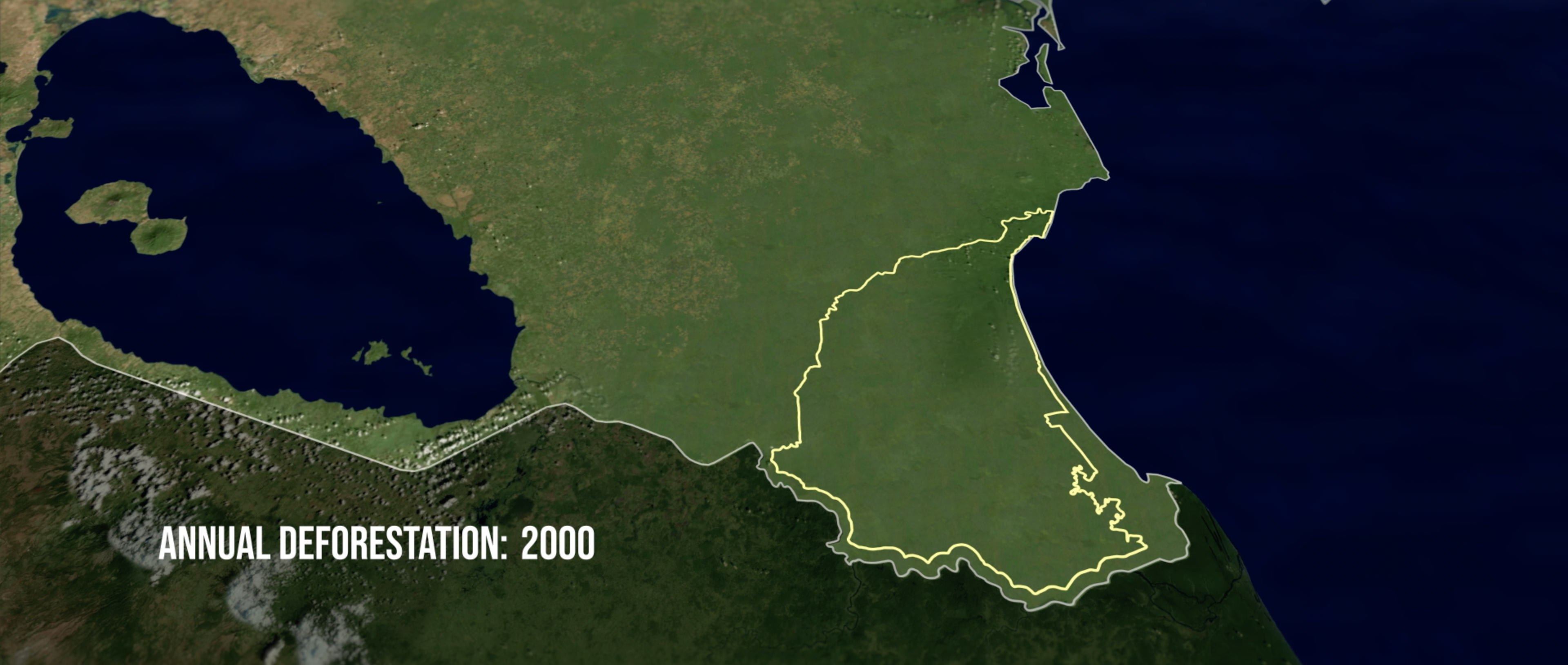
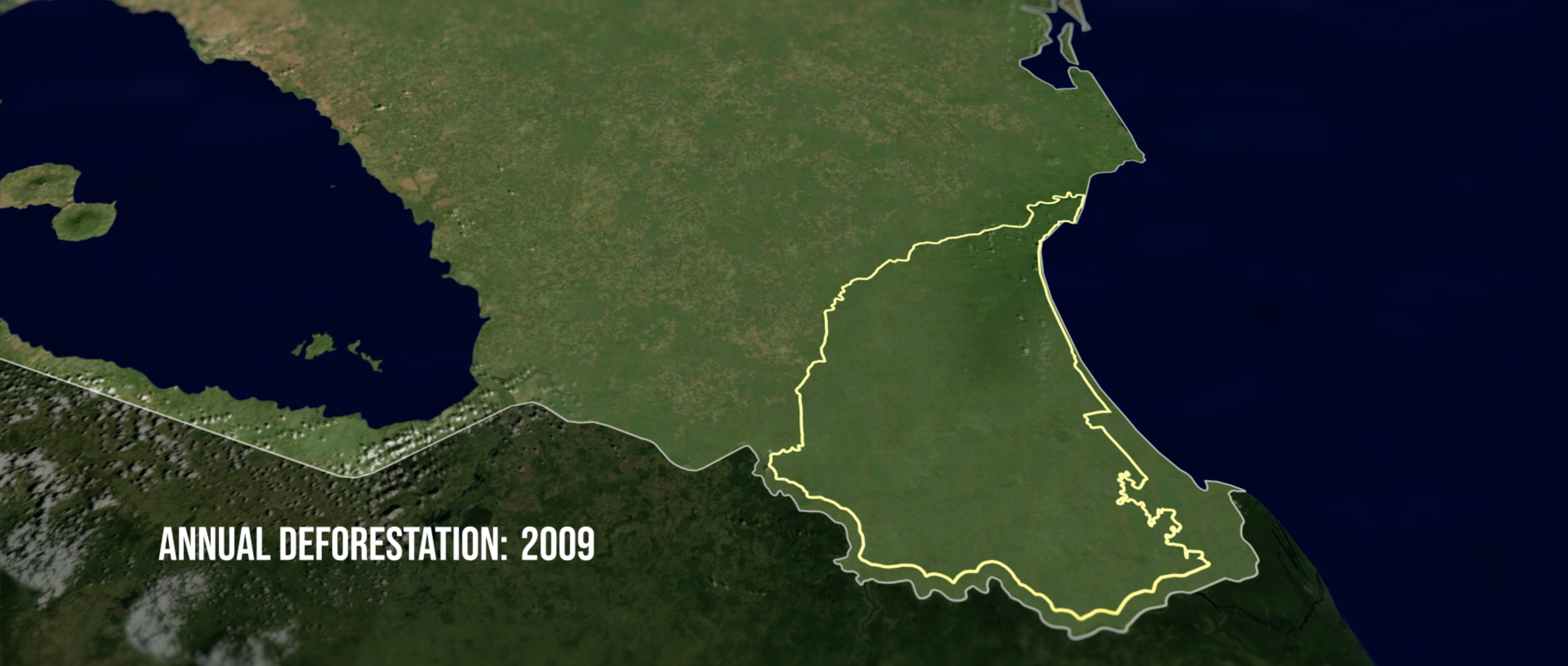
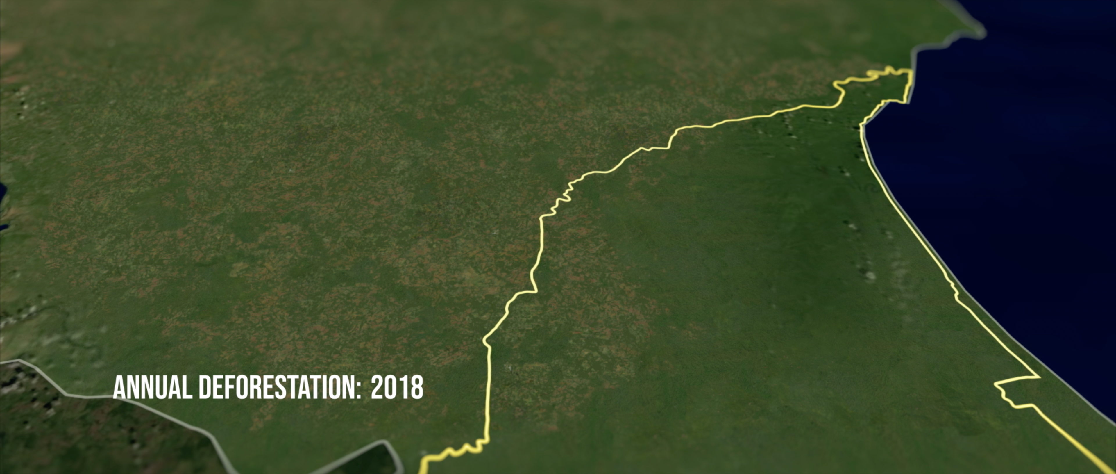
For an establishing montage of the film they wanted to splice animated time lapse map graphics between footage contextualizing the social and political order in the country. Each return to the map graphic the viewer and apparent forest clearing graphic would be increasingly closer to the border line of the reserve. A year counter indicating annual deforestation progress aids the audience in understanding how quickly the deforestation has been occurring.
Color scheme options pulled directly from frames of the film
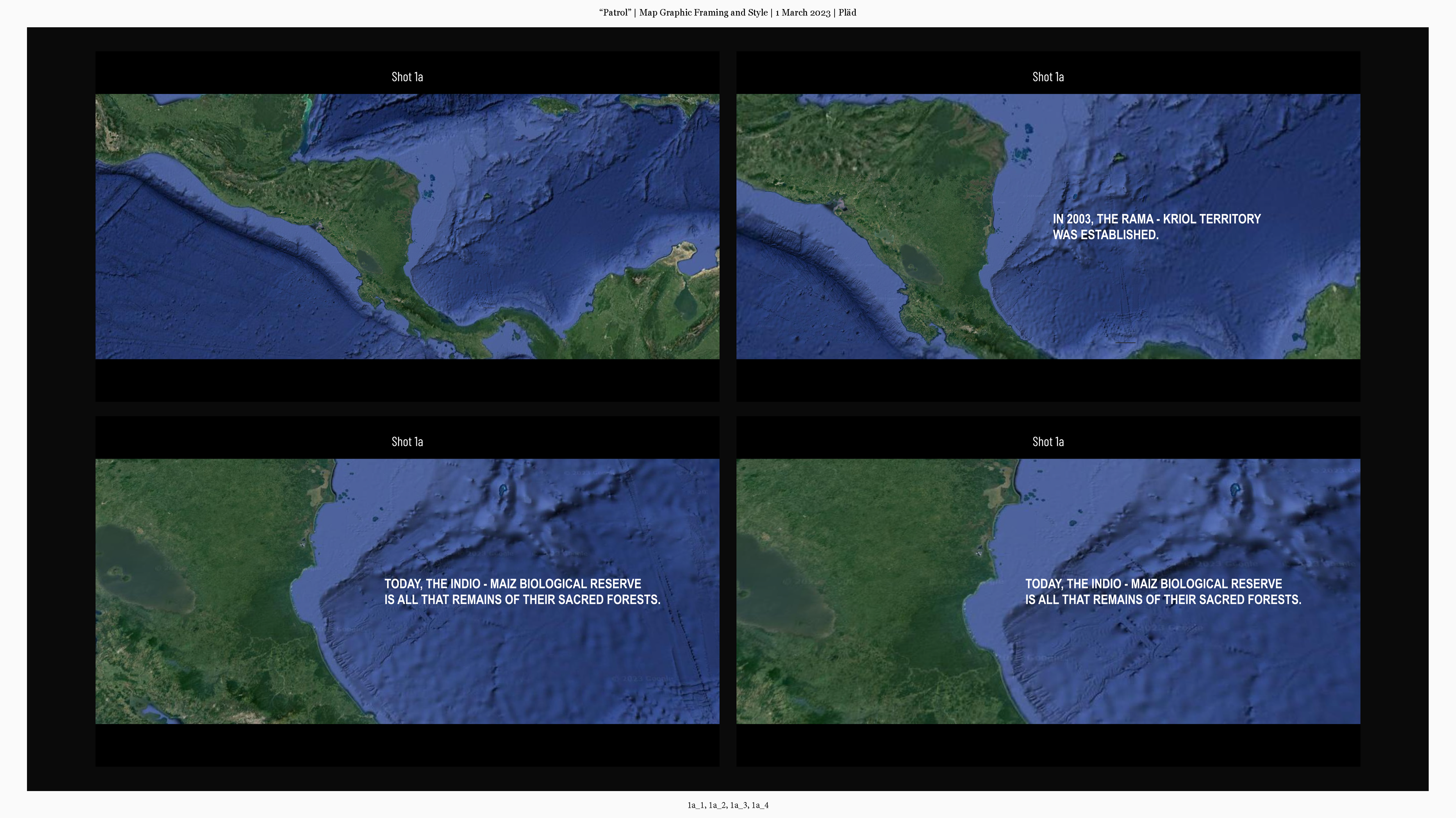

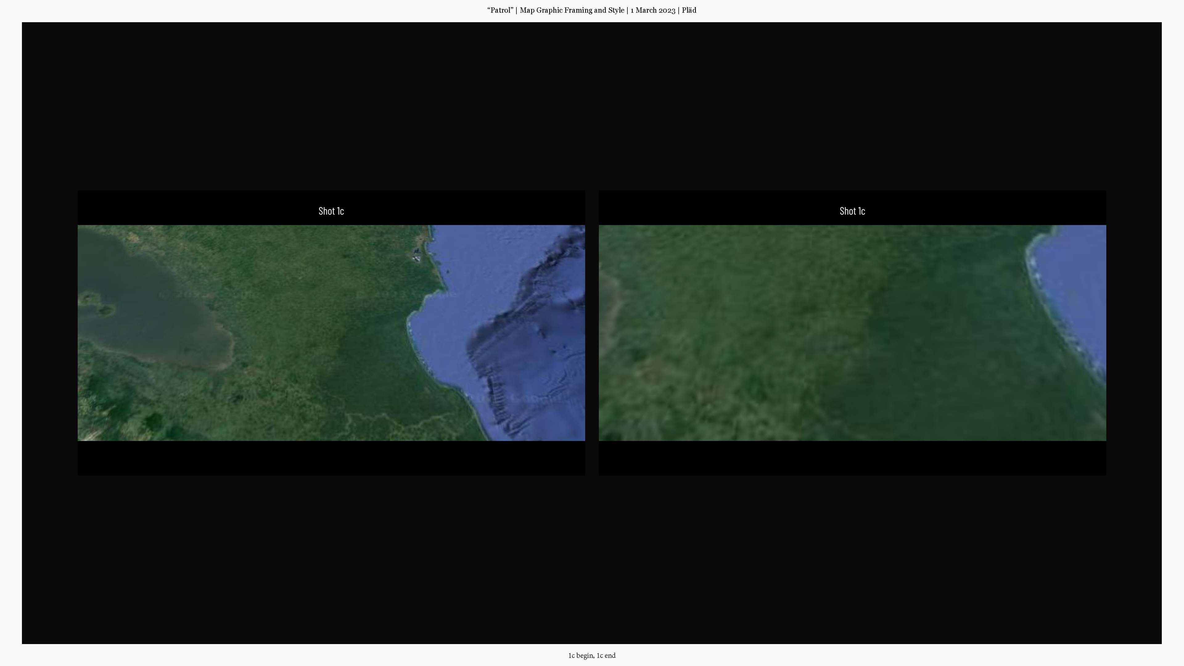

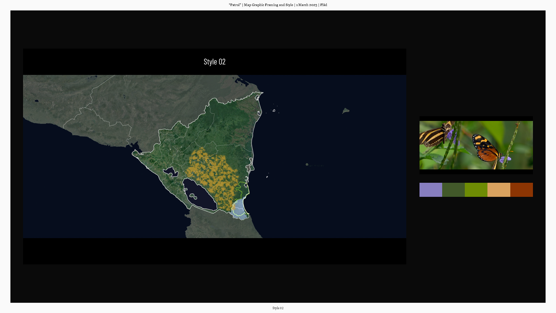


After the filmmakers decided on the details of color scheme, opting for a more natural appearance such that a satellite might offer over a charted graphic map illustration, I set out developing an animation style to depict deforestation trends for the past couple decades. I was able to extrapolate a depiction of land clearing across time to fair accuracy thanks to data maps provided by the filmmakers. I used an animated track matte to reveal clearly deforested land.
Select stills from shots 01a, 01b, and 01c beginning in establishing wide to specific perspective


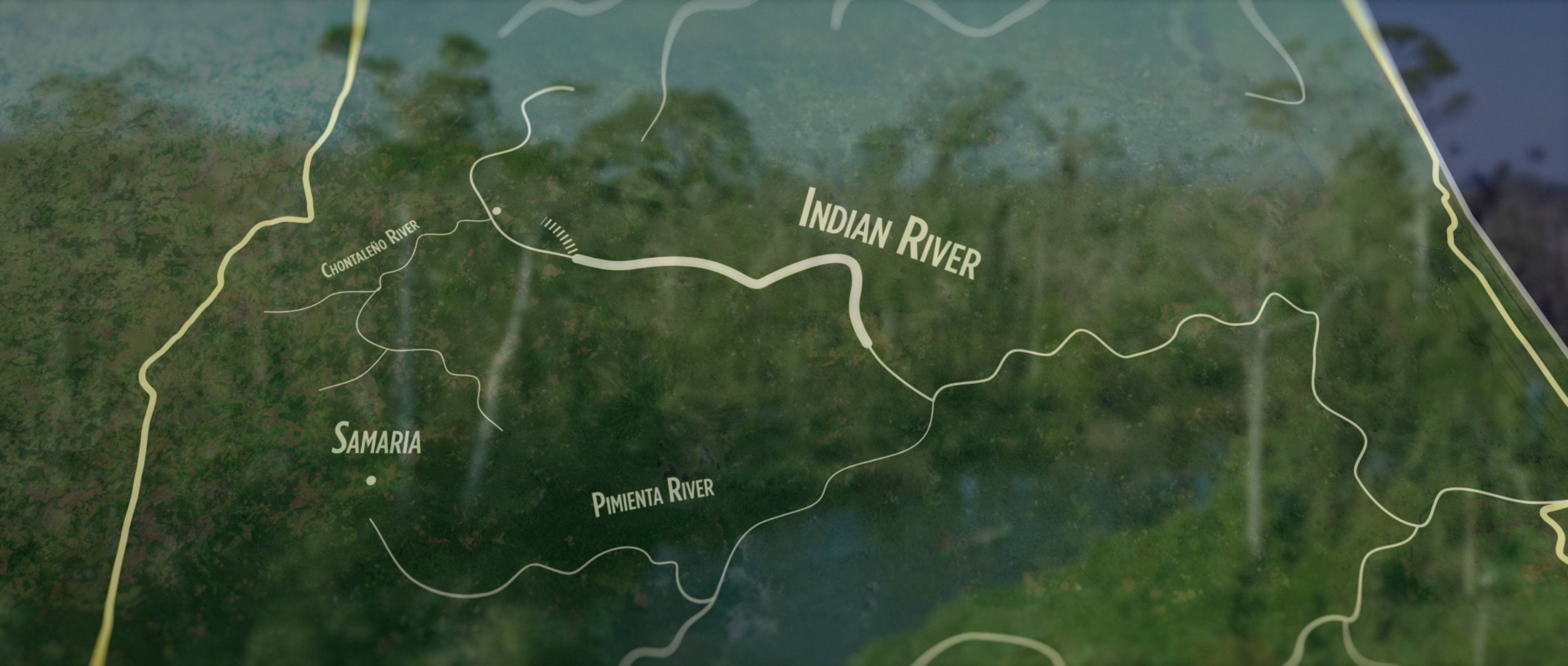
The filmmakers further desired overlays for footage of patrolmen navigating rivers to reach and document illegal cattle ranches. Further aided by highly detailed maps, these animations further aid the viewer in establishing position within the film's setting.
Select stills from shot 2 depicting patrolmen navigating to illegal cattle ranches via river and

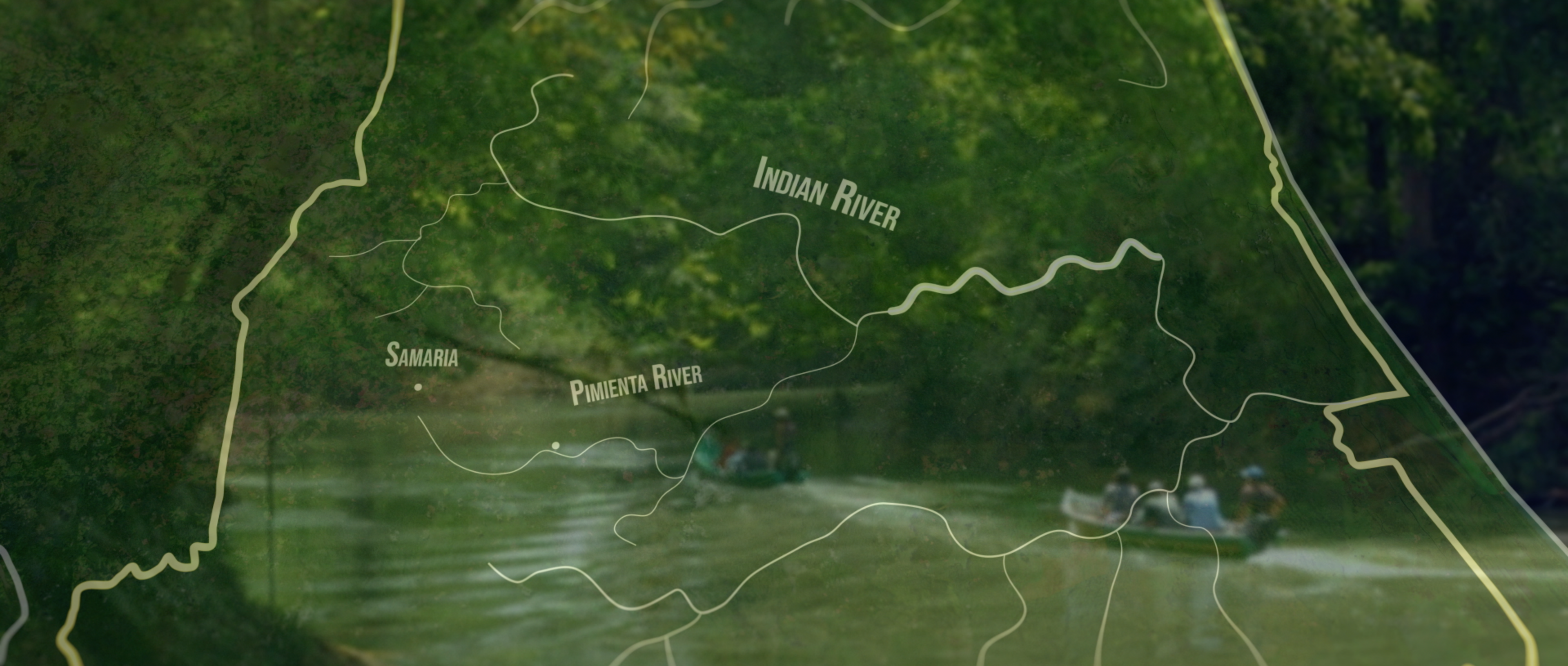

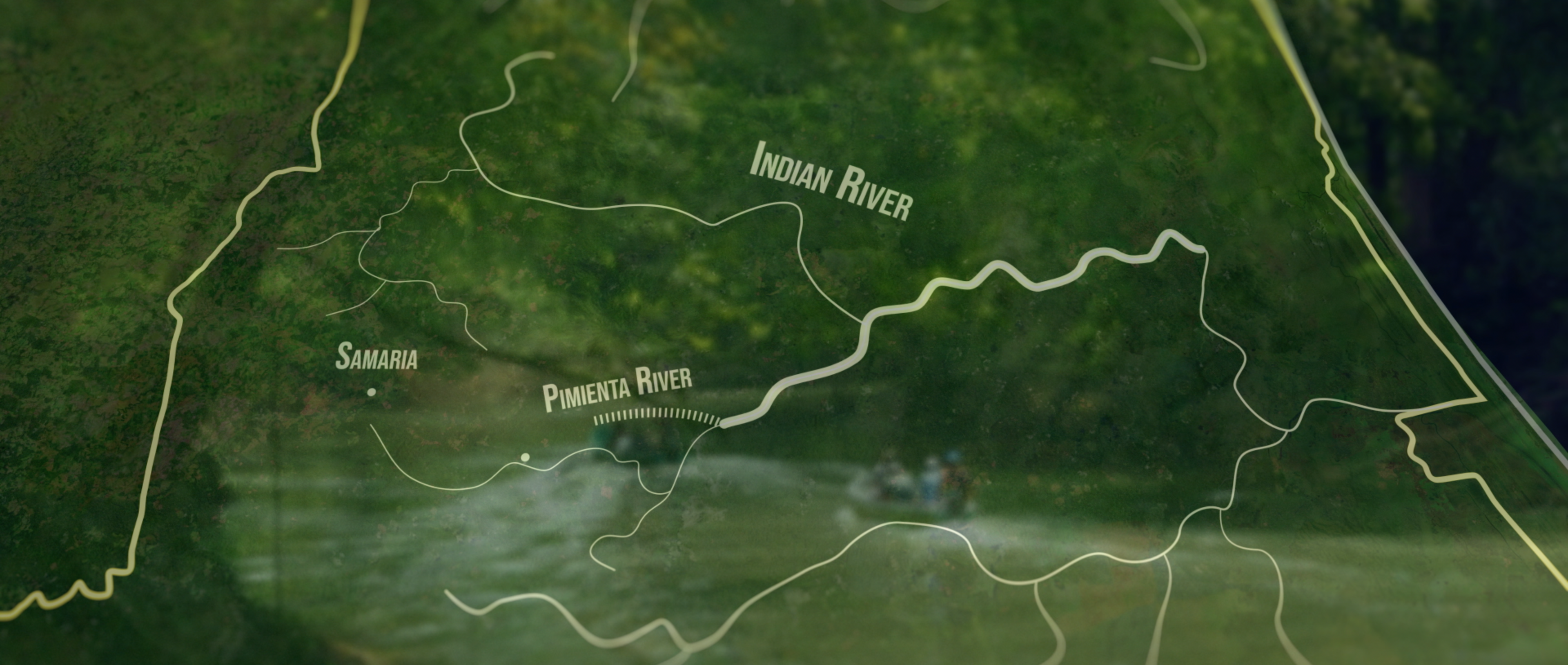
Select stills from shot 3 depicting patrolmen navigating to illegal cattle ranches via river and land


Reflection
This is specifically among the sort of projects that my business partner and I initially started our studio to take part in. Though budgets for such films tend to be modest as they are often built on small donor fundraising and grants, the commitment to injecting sweat equity contributes to people- and world-friendly messages getting produced and distributed. Bravo to the documentarians!
1. Final map graphic sequences establishing the setting for the documentary (explicitly selected from film for brevity)
2, 3. English and Spanish versions of "traveling" map graphics for audience specific cuts of the film